|
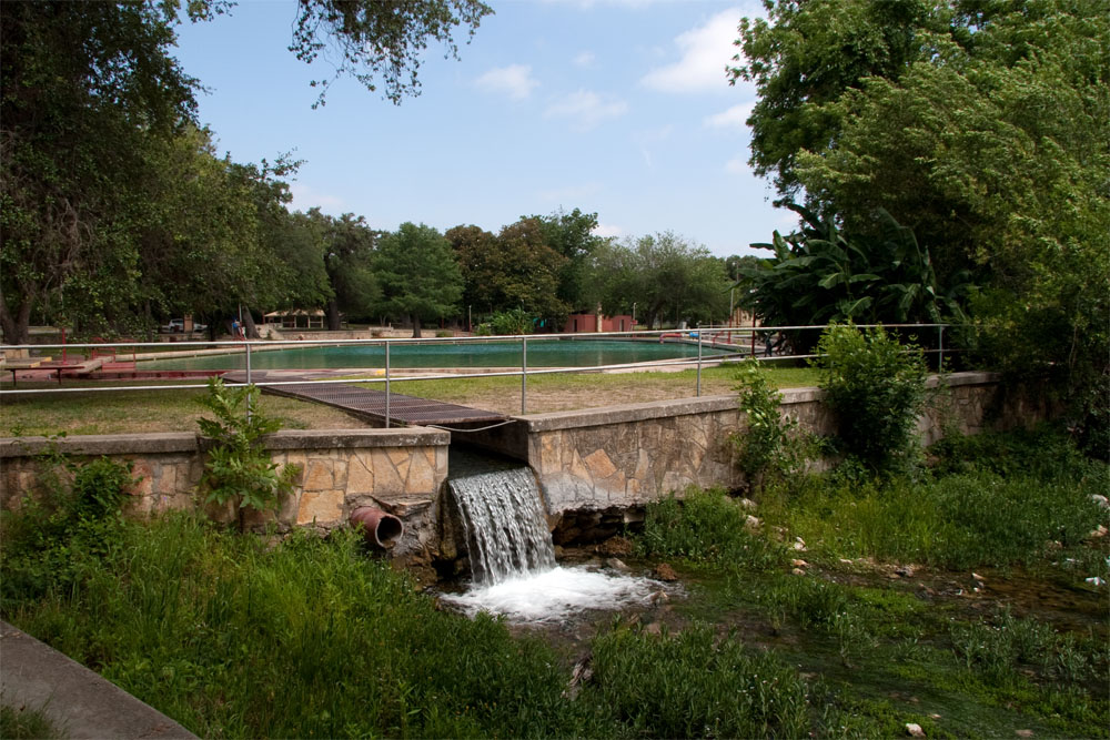
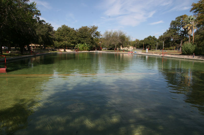
Las Moras Springs are located on the grounds of Fort Clark in Brackettville and are the ninth largest group of springs in Texas, discharging an average of about 12 -14 million gallons per day. They rise under artesian pressure through a fault that overlies Edwards limestone, emerging at an elevation of about 1,096 feet (Brune, 1981). The springs fill a large walled-in area which spills into a 300-foot long swimming pool, with excess flows diverted to a bypass channel around the pool. Just below the pool, both discharges combine and form the headwaters of Las Moras Creek. |
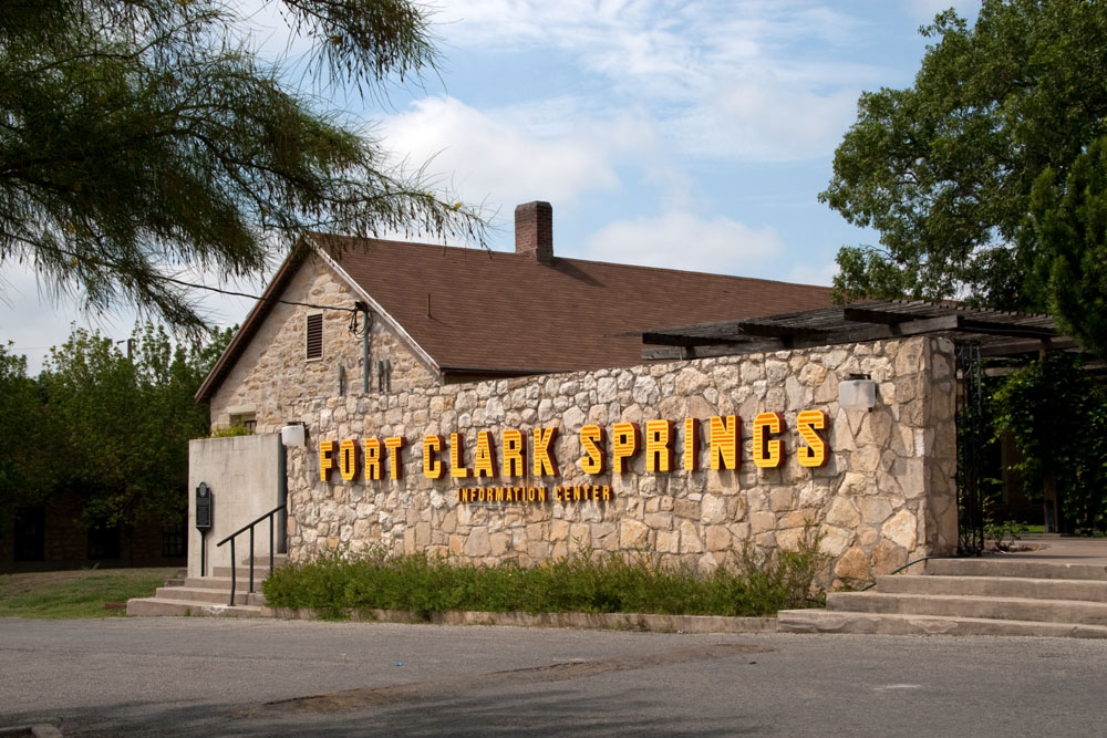
Fort Clark is no longer an active military installation. In 1971 it was purchased by North American Towns of Texas and developed into a private recreation and retirement community (FCSA, 2008). Visitors are welcome, and guards will issue a pass to persons interested in seeing the Springs or touring the grounds.
 |
The information center at Fort Clark. Visitors are welcome. Check in with the guard and you can get a pass to go visit the springs. |
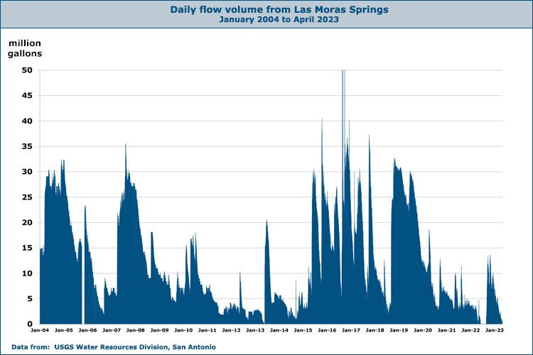
Springflow rates vary in response to weather conditions and respond quickly to rains in the West Nueces River basin. In his work at the Texas Water Development Board, Gunnar Brune estimated 51 flow rates for years between 1896 to 1978, and these ranged from a high of 38.8 to million gallons per day (mgd) in 1899 to lows of 3.6 and 2.6 mgd in 1964 and 1971. In those two years, the Springs dried up completely for a time. Begining in 1998 the USGS recorded occasional field measurements of flow, and in October of 2003 a permanent gage was installed for continous measurement. Real time flow data is available from the USGS at this location.
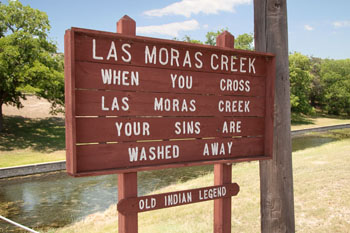
Las Moras Springs were used for thousands of years by prehistoric people. Projectile points as old as the Plainview type have been found, indicating a human presence at least 8,000 years ago. It was long a favorite site for diverse cultures and tribes that anthropologists have lumped together as "Coahuiltecan", and later for Comanche and Lipan Apache tribes. Spanish explorers began to camp at the Springs in the 16th century and gave them their name, which means "The Mulberries". In 1840 a U.S. cavalry unit drove Comanches from their village by the Springs, killing many Indian women and children. At that time, many bison, antelope, and wild mustangs roamed the area (Brune, 1981).
In 1896 R.T.
Hill and T. W. Vaughan, the geologists who first described the Edwards Aquifer, wrote:
They break out from the Eagle Ford shales and
form extensive headwater pools, around which are built the military post of
Fort Clark and the county town of Brackett, both of which are supplied with
water from it. The run-off forms a beautiful, limpid stream, which is
largely used for irrigation a few miles below Fort Clark. Mr. Babb has
measured the flow of these springs and estimates it to be 21 second feet, or
over 13,000,000 gallons per day.
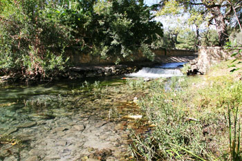
Below the Springs, Las Moras Creek flows southwesterly for 29 miles to the Rio Grande in Maverick County, and it is partially intermittent along some stretches. The first European settlement in the area was Dr. John C. Beale's Villa de Dolores, located on Las Moras Creek about nine miles below the Springs. Settlers constructed grist and sawmills that used spring water for power, but the town only lasted a year. Colonist Sarah Ann Horn reported the main reasons the settlement was abandoned were Comanche attacks, the intermittent nature of the stream, and crop failure due to leaching salts that covered the land around Las Moras Creek (Rister, 1955).
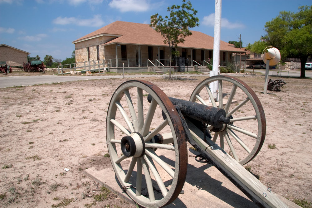
Around 1848, San Antonio businessman Samuel A. Maverick acquired the lands around the Springs, and in 1852 he leased them to the U.S. government for the establishment of a cavalry post. It was known for a few weeks as Fort Riley, in honor of the commanding officer of the First Infantry, but was renamed at Riley's request to honor Major John B. Clark, a deceased officer who had served in the Mexican War. Along with other posts like Fort Inge in Uvalde, the purpose of the Fort Clark was to protect the road from San Antonio to El Paso and defend area settlements from Indian depradations (FCSA, 2008).
The neighboring civilian settlement of Las Moras was established soon after the Fort, and the name was later changed to Brackettville. For almost a century the town and the Fort were closely identified. The Springs irrigated gardens and crops, powered an ice plant, and were an important stopping place for emigrants bound for California. During this time, Fort Clark was home to many infantry regiments and almost all mounted cavalry regiments. Many famous officers served here, including General George S. Patton and General John L. Bullis. In the 1870s, many sturdy limestone buildings were constructed, and over 40 nicely restored buildings form today's Historic District.
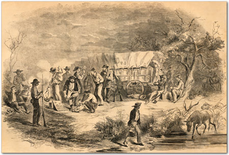 |
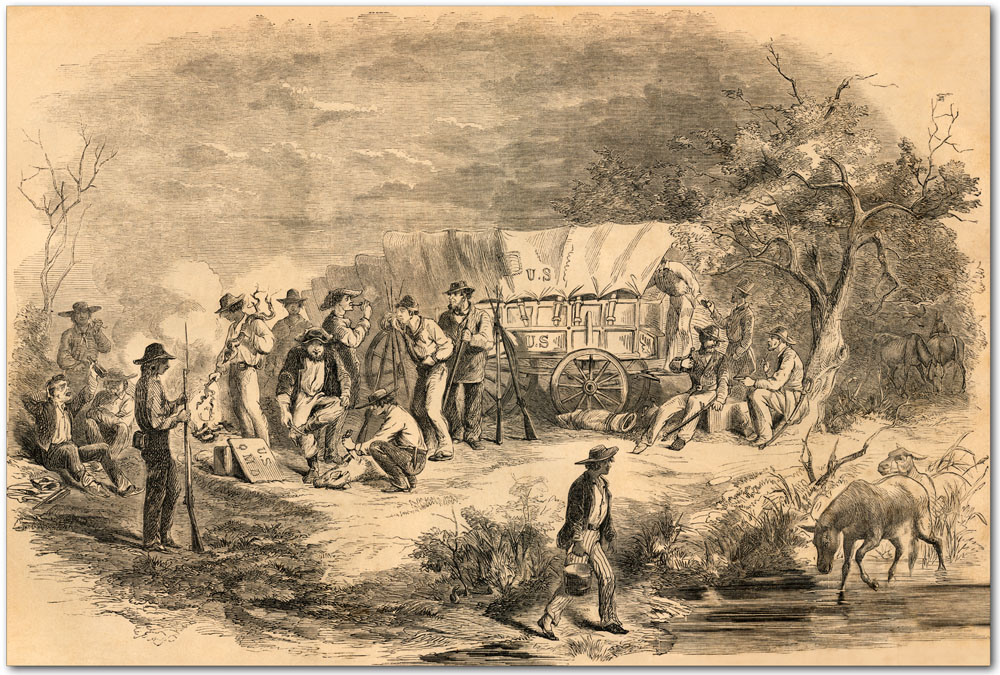
This engraving entitled "Bivouac of Confederate Troops on the Las Moras, Texas, with Stolen U.S. Wagons" appeared in the June 5, 1861 edition of Harper's Weekly. |
 |
A version of the original 1861 engraving that was professionally hand-colored by an artist in 2023. |
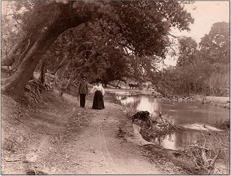 |
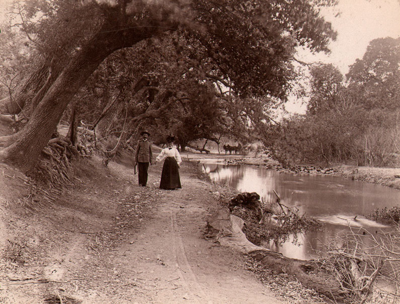
A late 19th century lobby card with a couple walking along Las Moras Creek at Fort Clark. |
By 1911, there was no need to protect settlers from Indian attacks and the Texas Anti-tuberculosis Commission was charged with identifying suitable locations for state sanitariums. Texas congressmen caused an amendment to be made to an army appropriation bill whereby the War Department was authorized to sell the Fort Clark reservation or any portion of it to the state for such uses. A survey and appraisal was made, but about that time the area began having trouble with Mexican bandits and cattle rustling and the movement to sell Fort Clark was quickly abandoned.
By the end of World War II, those troubles were overwith and technology had made horse mounted units obsolete. The post was declared surplus in 1945 and officially deactivated in 1946. It was sold to Brown & Root Company for salvage and later used as a guest ranch and corporate retreat site.
In the summer of 1964 when the Springs dried up completely, the Fort Clark Springs Association drilled two wells into the Edwards Aquifer adjacent to the Springs, and a pump station there is still in use. The town of Brackettville also drilled a well at that time to replace the Springs as its water supply.
Today, a beautiful picnic area named Rendezvous Park surrounds the Springs with large groves of ancient oak and pecan trees. At the adjacent swim park, there are picnic tables and barbecue pits. The Springs still feed the swimming pool, which remains at a constant temperaure of 68 degree year-round. Along Las Moras Creek, fishermen, hikers, and picnickers enjoy seven miles of beautifully wood and publicly accessible creek front.
Daily discharge measurements by the USGS began in 2003 and show that flows rarely exceed 30 million gallons per day. Flows rates can rise precipitously after rain events and afterwards there is usually a long slow decline, sometimes falling to a rate of just a few million gallons per day. Springflows reached essentially zero in the spring of 2013 but recovered quickly when generous rains fell over the region in May. On August 6 of 2014, the USGS moved the gage to a new location about 600 feet downstream. Springflows reached zero again in June of 2022 and remained zero until rains fell in August. Both 2023 and 2024 saw long periods when springflow was zero, but the springs came alive again in early 2025. For the latest Las Moras springflows see the USGS Real-Time data page.
|
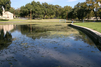 |
The Springs arise in this large walled-in area. The concrete walls were poured on February 14, 1939, as evidenced by inscriptions made in the wet cement. |
|
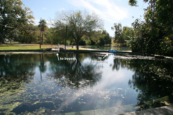 |
Enlarge the view of this photo for a better view of the labels that show the division of flow to the swimming pool and/or a bypass canal. As springflows fluctuate, this scheme enables the flow to the swimming pool to be maintained at a favorable rate. |
|
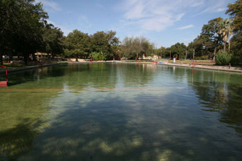 |
A view of the swimming pool looking upstream towards the Springs. |
|
 |
Water in the bypass canal enters Las Moras Creek just below the swimming pool. |
|
 |
I am all in favor of this. Hope it works. |
|
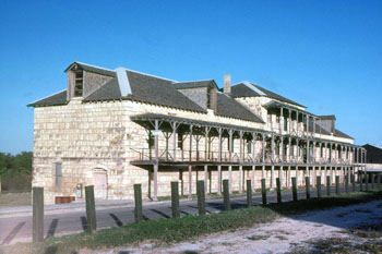 |
Several dozen nicely restored frontier era buildings remain on Fort Clark, one of the largest collections anywhere. |
|
 |
Another of the restored buildings. About 1,500 WWII era wooden structures were demolished after the war, but the earlier stone structures were spared. |
|
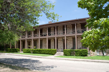 |
Surrounding the parade grounds, many restored buildings that previously housed officers are now private residences. |
|
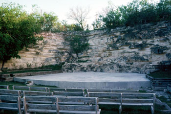 |
A quarry site that produced stone for many of the buildings has been converted into an ampitheatre that can accommodate 300 or more. |
|
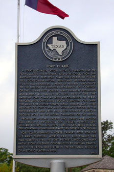 |
Historical marker on the Fort. |
|
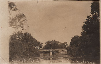 |
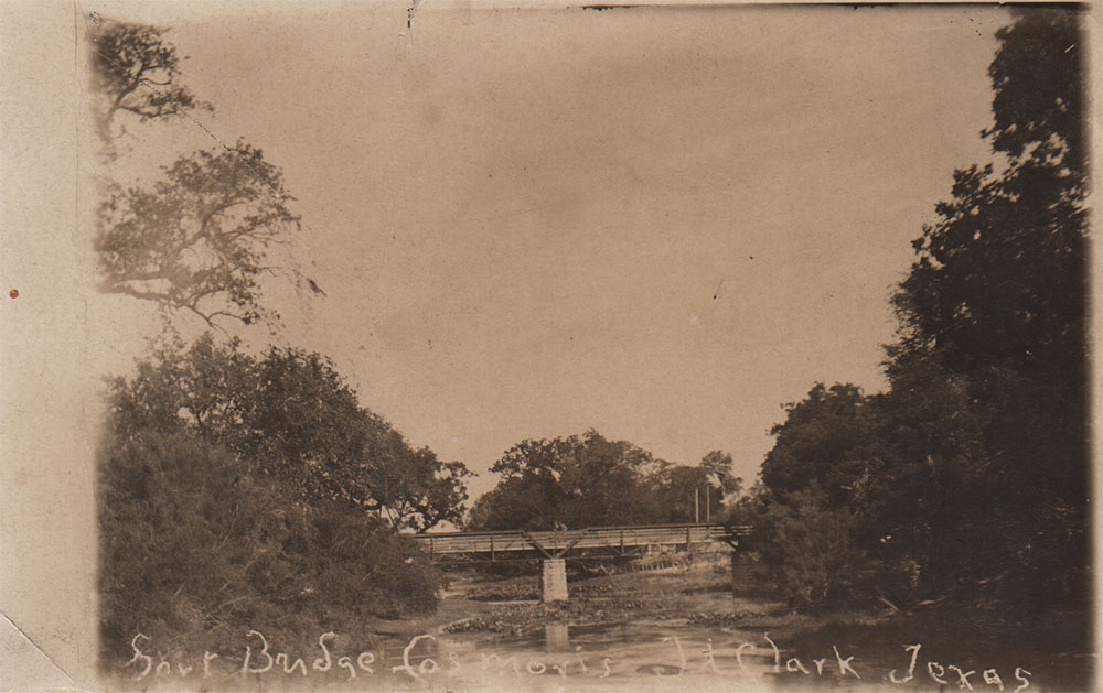
A view of the Fort Bridge over Las Moras Creek, mailed from Brackettville on February 8, 1911. |
|
 |
On the back someone provided a date of 1918 and wrote:
This spring used to supply water for 40,000 troops. General Robert E. Lee was here in 1848. |
|
 |
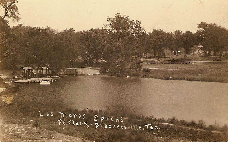
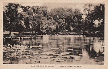
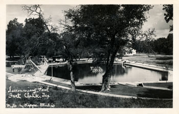
A very rare Real Photo Postcard of the upper pool area. Never mailed, but the stamp box on the backside is a type that was in use from 1918 to 1930. A note on the back says:
If it weren’t for this Spring this Fort would not be here because this is the only water hole for more than a hundred miles from here. |
|
 |
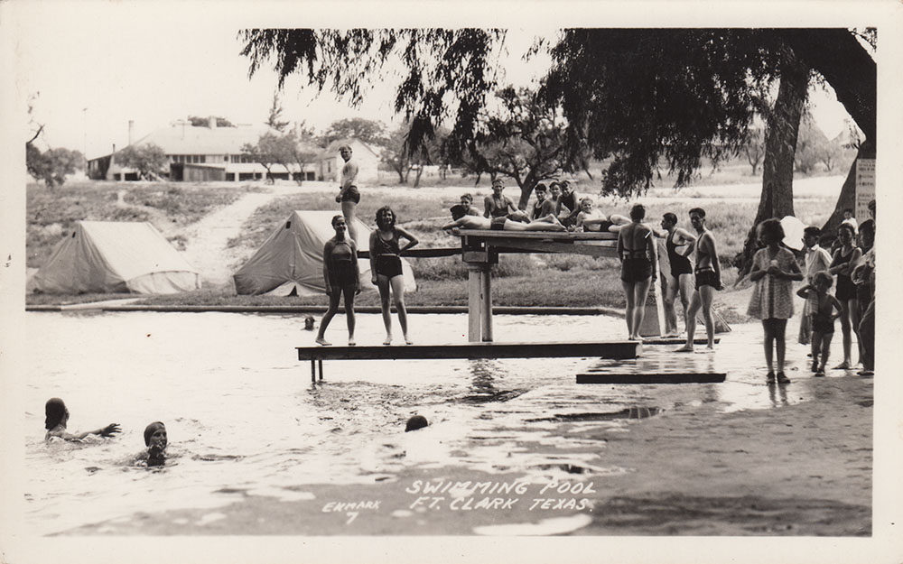
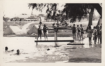
Another very rare Real Photo Postcard of swimming hole at Fort Clark from about 1920. |
|
 |
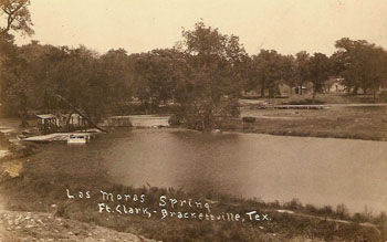
A view of the pool mailed from Brackettville in 1932. |
|
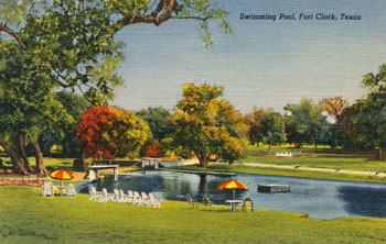 |
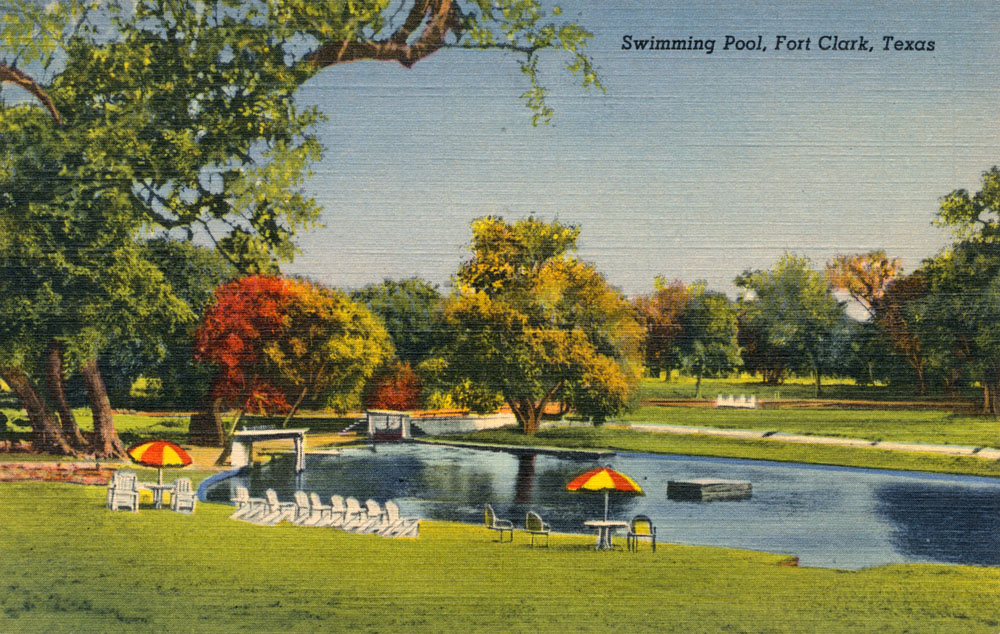
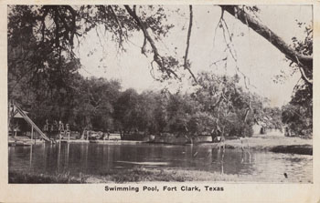
A view of the swimming pool that appears to be from the late 1930s. An extensive construction project was carried out in 1939, in which this dirt-bottomed pool was replaced with the current concrete one. This Curt Teich card has a 1943 production date, so it appears that Mr. Teich used an image that was already several years old. The back caption says:
Swimming Pool, Fort Clark. Water from famous Las Moras Springs. 14,000,000 gallons daily. |
|
 |
Excellent for its super-sharp clarity, this Real Photo card does not have a postmark but I have many other cards of identical manufacture and style that are postmarked in the early 1940s. What Melvin wrote on the back of the card is still true:
This is one of the nicest things Fort Clark has. Love, Melvin |
|
 |
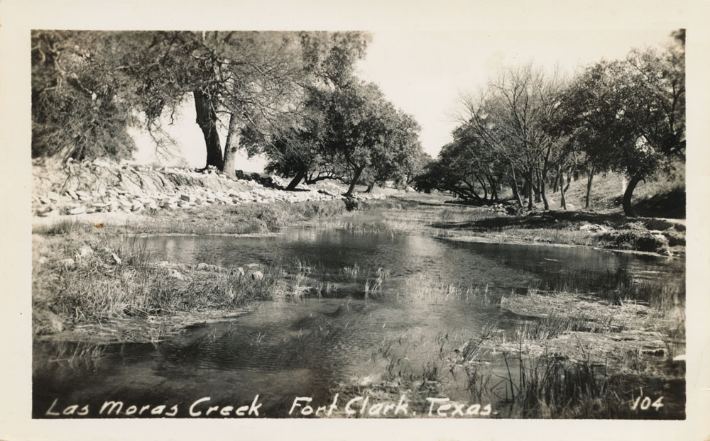
A view of Las Moras Creek, also of a manufacture that was very common in the early 1940s. |
|
 |
A Real Photo card that appears to be from the 1940s. |
|
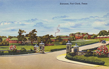 |
Another Curt Teich card with a 1943 production date, showing the entrance to Fort Clark in the early 40s, or possibly the late 1930s. |
|
 |
These were used to confirm hotel reservations at the Fort Clark Springs hotel. The back says:
Riding the winding trails of The McKenzie Raiders through green glens and reflecting waters of Las Moras Creek bring memories of the old West in beautiful Fort Clark Springs. |
|
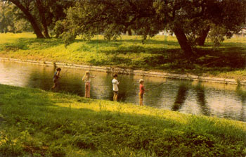 |
Never mailed, the caption on the back says:
A lazy day of fishing for Bass and Catfish in the headwaters of the beautiful banks of Las Moras Creek. Truly a fisherman's paradise in the wooded wonderland of Fort Clark Springs, Brackettville, Texas. |
|